Mission
Design a single intuitive platform that provides operators a real-time view of London’s transport network, supporting complex workflows for diverse user roles and surface critical information in real time from detection to resolution.
Impact
15% improvement of the London Road network performance
Role
- Lead UX designer
- Stakeholder management
- Design system
- Research
- Prototyping
- Usability testing
Why was this project needed?
Necessary outcomes
- Provide users a common view of the network to make quick decisions
- The solution had to be extensible and support future integration
- Support staff to meet Mayoral road safety targets
Identified usability problems from discovery
- Extensive manual data capture required to record an incident
- Operators cannot edit an incident location
- Communications were not integrated and had to be managed separately
- Multiple key systems were not integrated
- Operators had to navigate long and complex workflows for common activities
- Any browser update would break the system
- Network/system performance
- No analytics or metric gathering capability
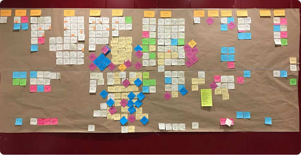
Discovery & roadmapping
I led a month-long discovery phase, identifying key users and stakeholders. I ran workshops to map current (“as-is”) and future (“to-be”) journeys. This directly shaped the product backlog and gave us clarity on the minimum viable product (MVP). Without historical analytics, this qualitative insight was critical to prioritisation.
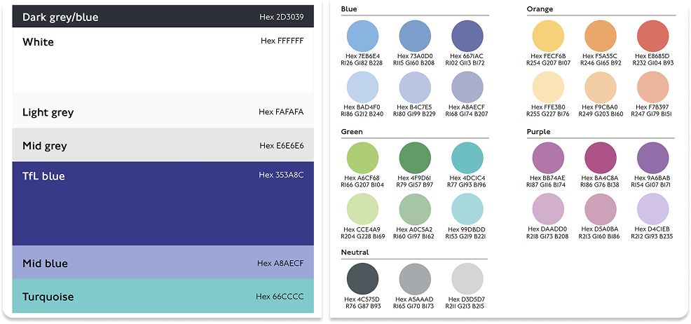
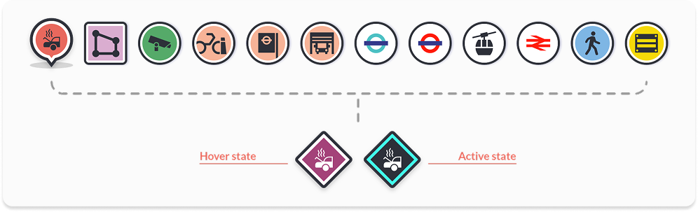
Design system
TfL had a mature public facing design system, but internal tools lacked anything as structured. I extended both TfL’s internal design guidelines and the Government Design System (GDS) to create a consistent, scalable design language for COV IMS. I defined reusable components and established interaction patterns tailored for complex map interactions, ensuring consistency across teams.
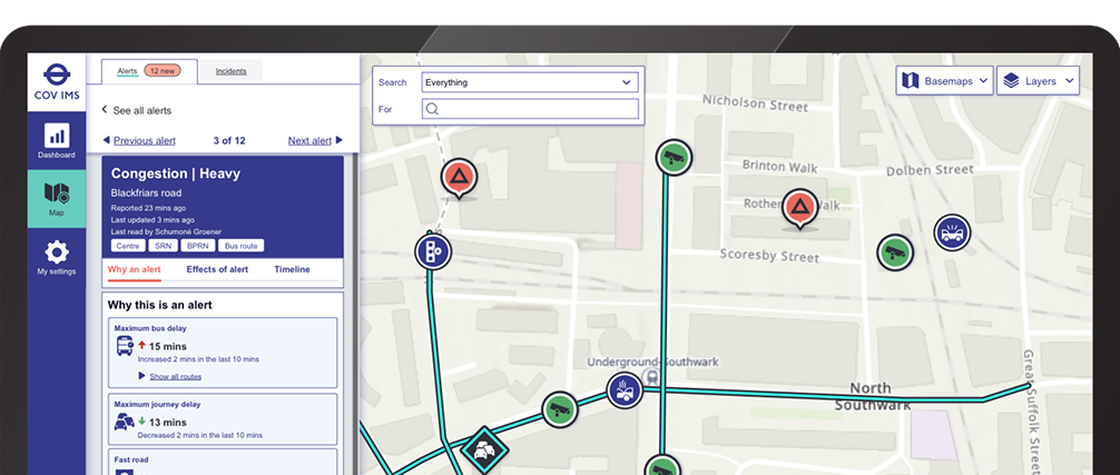
Accessibility and mapping
One key challenge was designing an accessible map-based interaction model, something I had limited prior experience with. I collaborated with developers and tested early prototypes with users with accessible needs to establish a model that allowed users to interact with map markers, toggle layers, and filter information intuitively. Through usability testing, I defined clear visual states and accessible control mechanisms.
Prototyping
I adopted an iterative prototyping approach, using tools like Figma, Sketch, and code-based prototypes. Each feature went through hypothesis-driven design and testing cycles. I worked closely with developers to scope features appropriately and gathered regular user feedback to refine interaction flows and visual design.
Outcomes of the project
- 1 Since going live there has been a 15% increase of the London Road network performance
- 2Multiple unsupported systems have been decommissioned and relevant data has been absorbed by COV IMS
- 3Staff have a centralised view of the overall performance of the network
- 4The system and its technologies are supported by TfL’s own Technology and Data team
- 5Early warning of problems on the network so Co-ordinators can mitigate them before they become more severe